Bykhaw
Bykhaw (Бы́хаў, Łacinka: Bychaŭ, ) or Bykhov (Бы́хов, Bychów, Bihov,, Bychavas) is a town in the eastern Belarusian Mogilev Region. It is located 44 km south of Mogilev (M on the Dnieper River (Dniapro), and is the administrative center of the Bykhaw District. As of 2009, its population was 17,031.
In the early modern times Bykhaw was an important fortress known for hard battles.
Bykhaw is known for its 17th-century synagogue. During World War II, Bychaw was occupied by the German Army from 5 July 1941 until 28 June 1944 and placed under the administration of the Generalbezirk Weißruthenien of Reichskommissariat Ostland. The Jews of Bykhov were killed in two mass shootings in September and November 1941. According to the German and Soviet archives, there were 4600 Jews from Bykhaw who were shot in Voronino.
There is an abandoned military airfield, Bykhov airfield inside a military town called Bykhov-1, which is now a microdistrict of Bykhaw.
Map - Bykhaw
Map
Country - Belarus
 |
 |
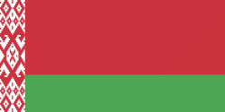
| Flag of Belarus | |
Until the 20th century, different states at various times controlled the lands of modern-day Belarus, including Kievan Rus', the Principality of Polotsk, the Grand Duchy of Lithuania, the Polish–Lithuanian Commonwealth, and the Russian Empire. In the aftermath of the Russian Revolution in 1917, different states arose competing for legitimacy amid the Civil War, ultimately ending in the rise of the Byelorussian SSR, which became a founding constituent republic of the Soviet Union in 1922. After the Polish-Soviet War, Belarus lost almost half of its territory to Poland. Much of the borders of Belarus took their modern shape in 1939, when some lands of the Second Polish Republic were reintegrated into it after the Soviet invasion of Poland, and were finalized after World War II. During World War II, military operations devastated Belarus, which lost about a quarter of its population and half of its economic resources. The republic was redeveloped in the post-war years. In 1945, the Byelorussian SSR became a founding member of the United Nations, along with the Soviet Union.
Currency / Language
| ISO | Currency | Symbol | Significant figures |
|---|---|---|---|
| BYN | Belarusian ruble | Br | 2 |
| ISO | Language |
|---|---|
| BE | Belarusian language |
| RU | Russian language |


